| |
Geomagnetism |
|
| Home | Magnetic Field Overview | Model and software downloads | Online Calculators | Magnetic Data Sources | Geomagnetic Tutorials |
|---|
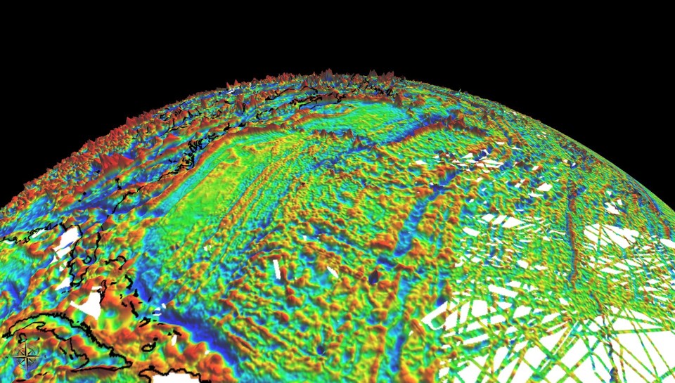
Marine and airborne magnetic anomaly data have been collected for more than half a century, providing global coverage of the Earth. Due to the changing main field from the Earth's core, and due to differences in quality and coverage, combining these data to a consistent global magnetic grid is challenging. The World Digital Magnetic Anomaly Map (WDMAM) project is an international effort to integrate all available near-surface and satellite magnetic anomaly data. Teams of researchers were invited by IAGA and CWGM to produce candidate maps using a common pool of data sets. Following a scientific review of the candidate submissions, NGDC's grid (now called EMAG3) was chosen as a base grid for the WDMAM project.

Fig.1: (click to enlarge) NGDC candidate for the World Digital Magnetic Anomaly Map. Plug-in files for NASA World Wind can be downloaded from GETECH .
The WDMAM is specified as a global 3-arc-minute resolution grid of the anomaly of the magnetic intensity at an altitude of 5 km above mean sea level. It was compiled from satellite, marine, aeromagnetic and ground magnetic surveys (see our acknowledgement of data providers and collaborators). A version of the WDMAM for visualization in NASA World Wind can be downloaded from GETECH . See table below for a plugin for Google Earth.
| Available WDMAM Downloads | ||||
|---|---|---|---|---|
| Type | Format | Mbyte | Contents | |
|
|
Full resolution map | 38 | World Digital Magnetic Anomaly Map as a full resolution image file | |
|
|
Article | 5 | Reprint of our paper The NGDC candidate for the World Digital Magnetic Anomaly Map | |
|
|
Google Earth | KMZ | 5 | Plugin for Google Earth. Requires installation of Google Earth. Open this KMZ file with Google Earth, then look under "Places" and check "NGDC World Magnetic Anomaly Map". |
|
|
xyz/zip | zipped ascii | 142 |
Ascii grid of the magnetic total intensity at 5km above mean sea level. See Maus et al. (2007) for flag codes used in column 4. |
|
|
xyz | plain ascii | 855 |
Ascii grid of the magnetic total intensity at 5km above mean sea level. See Maus et al. (2007) for flag codes used in column 4. |
|
|
xyz.gz | zipped ascii | 42 | NGDC marine magnetic trackline data at sea level after line-leveling. For our candidate map these data were combined with the Project Magnet data at a common altitude of 5 km above mean sea level. |
|
|
xyz.gz | zipped ascii | 10 | Project Magnet aeromagnetic data at the original flight altitude (about 5 km) after line-leveling. For our candidate map these data were combined with the NGDC trackline data at a common altitude of 5 km above mean sea level. |